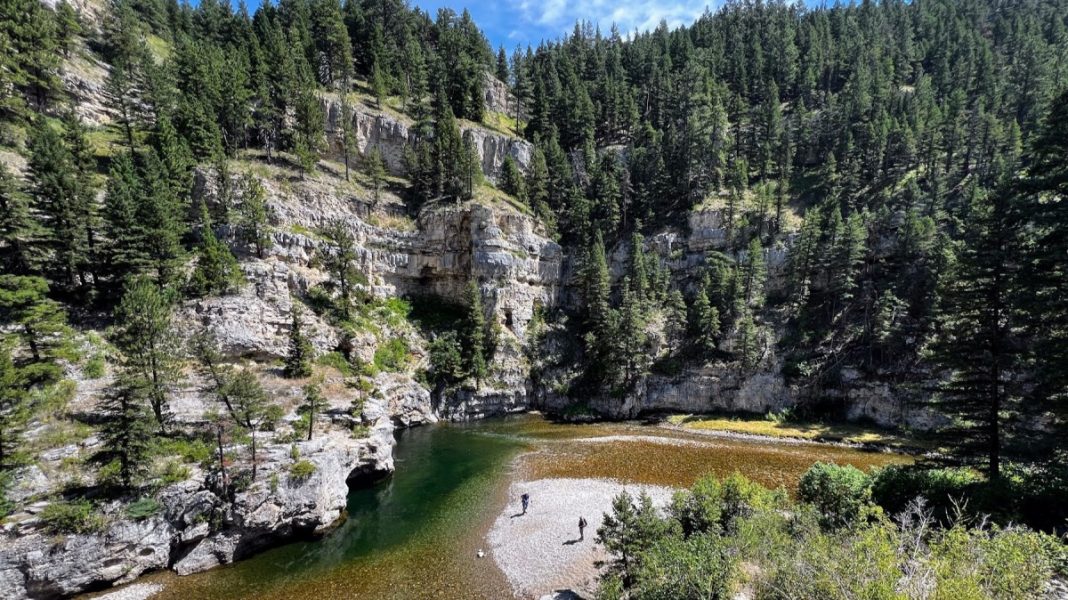
A Central Montana Gem.
My friend Kacey and I have taken a couple hikes in the Sluice Boxes State Park 34 miles southeast of Great Falls – both were fantastic! In July of 2022 we hiked the entire 6.5-mile trail from north to south, then caught a ride back to our starting point at the Evans-Riceville Trailhead, 13 miles south of Belt. Two years later (July 2024) we did an out-and-back hike with our wives, starting at the same trailhead (6 miles round trip).
Wet feet.
When the two of us hiked Sluice Boxes in 2022, we’d planned to walk the entire 6.5-mile trail from north to south, and then turn around and walk back – 13 miles with 32 stream crossings. We both wore old running shoes and accepted that we were going to be walking in wet shoes – squish, squish, squish. It was a very warm day, so we having wet feet wasn’t an issue but many of the crossings required wading through water that was mid-thigh deep, which might be a concern for smaller folks. Much of the trail was on the bed of an old railroad that was used to haul silver ore from mines near Neihart to a smelter in Great Falls from the late 1800s until the mid-1900s. Kacey and I enjoyed the rare combination of natural beauty and the remains of some interesting human engineering, including bridges, walls, and a nifty tunnel. As for natural beauty, the canyon that Belt Creek has carved out of the Madison limestone is amazing!
Enough already.
As much a we enjoyed our hike, by the time we reached the southernmost end of the park we were tired, plus it was getting late in the afternoon (3:30 ish) – the sixteen stream crossings had taken more time than expected. Fortunately, we met a fisherman and his wife who were about to drive north toward the trailhead where we started our hike at 9:30 that morning. They were kind enough to give us a lift, so we were able to spend some quality time at the Harvest Moon Taproom in Belt before driving back to Helena – a great ending to one of the best days of the summer of 2022.
Double date.
Kacey and I recognized that Sluice Boxes would be a great place to take our wives, so we made that happen in July 2024. This time we started at the same trailhead on the north end, hiked in about 3 miles, and then walked back to that northern trailhead, crossing the stream four times each way. The ladies were impressed, but the crossings were still a little challenging, giving us an excuse to do a little hand-holding. We also wanted to hike down and explore the area shown in the photo atop this page – a spot that we’d walked past in 2022. The time we spent there ended up being the highlight of the day. We swam, snacked, jumped off the cliff, and got a nice look at an amazing man-made wall that can only be seen from below. Check out the photo tour to see why we liked this spot so much. All total the leisurely 6-mile hike with 8 stream crossings took us 4.5 hours. Afterwards we shared a meal at the Black Eagle Brewery in Great Falls, before driving back to Helena – a day well-spent!
CAUTION: Most of the trail is pretty safe, however there are a couple scrambles and a few places where a slip could cause serious injury or death, plus you need to be super-careful at all the stream crossings. I would not recommend this hike for small children or clumsy people. The area is also habitat for black bears, rattlesnakes, and mountain lions, although we did not see any of these.
FYI – I recently started an Instagram account. I will try to post something interesting at least once a week. Check it out: rodbenson406
Below: This map marks hikes that have been featured on bigskywalker.com so far, including several in Glacier Park – Select full screen to expand, zoom in for more detail, or click on a marker for a link to the post.
.


